
The entire state of Colorado is filled with scenic drives. Many of these drives are designated as such, but others are just normal roads where you can’t help but admire the beauty that surrounds you. In fact, on my 1500 mile road trip through Colorado, once I got outside of major cities, there was only one area that I found boring. Every other road gave me beauty in some capacity, although the amount of beauty varied wildly.
While planning my trip, I tried to cram in as many Colorado scenic drives as possible. Some of these scenic drives work well in existing itineraries and you’ll drive them whether you planned to or not, while other scenic drives do require a detour.
Colorado Scenic Drives
This is not an exhaustive list of all of the scenic drives in Colorado. Rather, this is the list of the designated scenic drives that I did while on my road trip. Every scenic drive is worth it, but only some are worth actually going out of your way for.
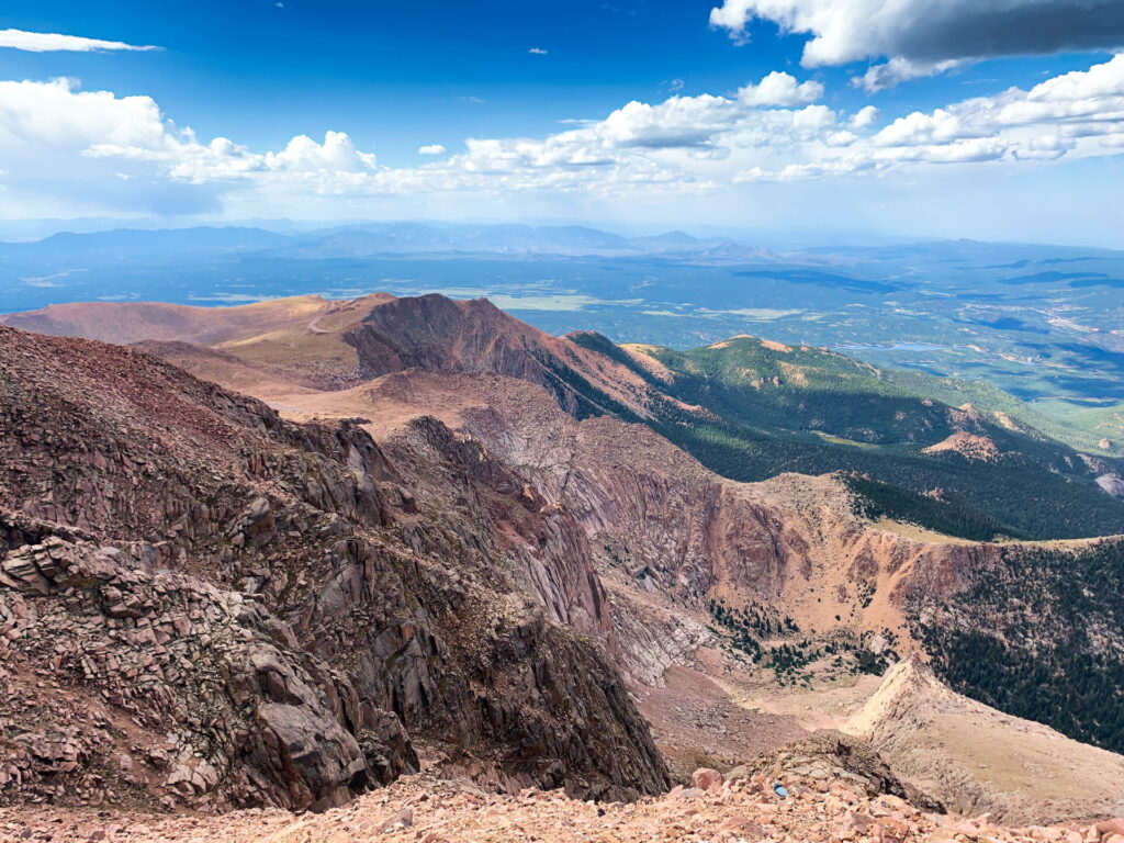
Pike’s Peak
Distance: 19 miles
Time: 1 hour (one way)
Where: Colorado Springs
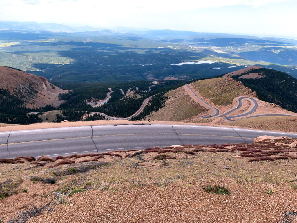
Nicknamed America’s Mountain, Pike’s Peak is an incredibly accessible 14,000 foot mountain (also known as a “fourteener”). While there are shuttles, and even a train, for those who don’t want to drive, Pike’s Peak is a great introduction to driving the mountains of Colorado.
You’ll wind your way up the mountain with pull offs for you to stop, get out, and snap a few pictures. It’s less than twenty miles, but expect it to take about an hour to make it to the top. Between the steep grade, low speeds, and stops for photos, it can be slow going, but it’s still an enjoyable drive.
Pike’s Peak costs $10 per adult to visit ($5 per child or $35 per carload) and can be purchased online at the official website in advance. In addition, you may need to purchase a timed entry if you’re traveling in summer or trying to visit for sunrise. You can find more information about timed entries on the official website.
When I visited, I made my timed reservation one month before I went in Colorado and there were plenty of spots available. Without a reservation, there’s no guarantee that you’ll be able to drive your own vehicle up the mountain. Additionally, if you’re concerned about visibility and bad weather, you can just purchase the timed entry in advance and then pay your $10 entrance fee once you arrive (which is what I did).
I mentioned that Pike’s Peak is a great place to learn to drive on Colorado’s mountains and I want to elaborate on that.
When you pull up, you’ll be instructed to turn off your air conditioning (if it’s a really hot day and your car’s air conditioning is running), since that can overheat your car’s engine. Then, the attendant will inform you that you need to drive in first or low gear on the way down. If you’re like me and live somewhere flat and have never had to use your low gear, they will show you how to use it. Be honest if you’ve never done this and need a little help. This could be the difference between you and your car making it down safely and burning up your brakes.
About half way down the mountain, there is a mandatory brake check, where they’ll measure the temperature of your tires. If you pass, you can continue on without stopping. If not, you will need to pull over and wait. I passed the inspection, but stopped anyway and there were definitely some people who didn’t listen and did not use low gear. As soon as I got out of the car, all I could smell was burning rubber!
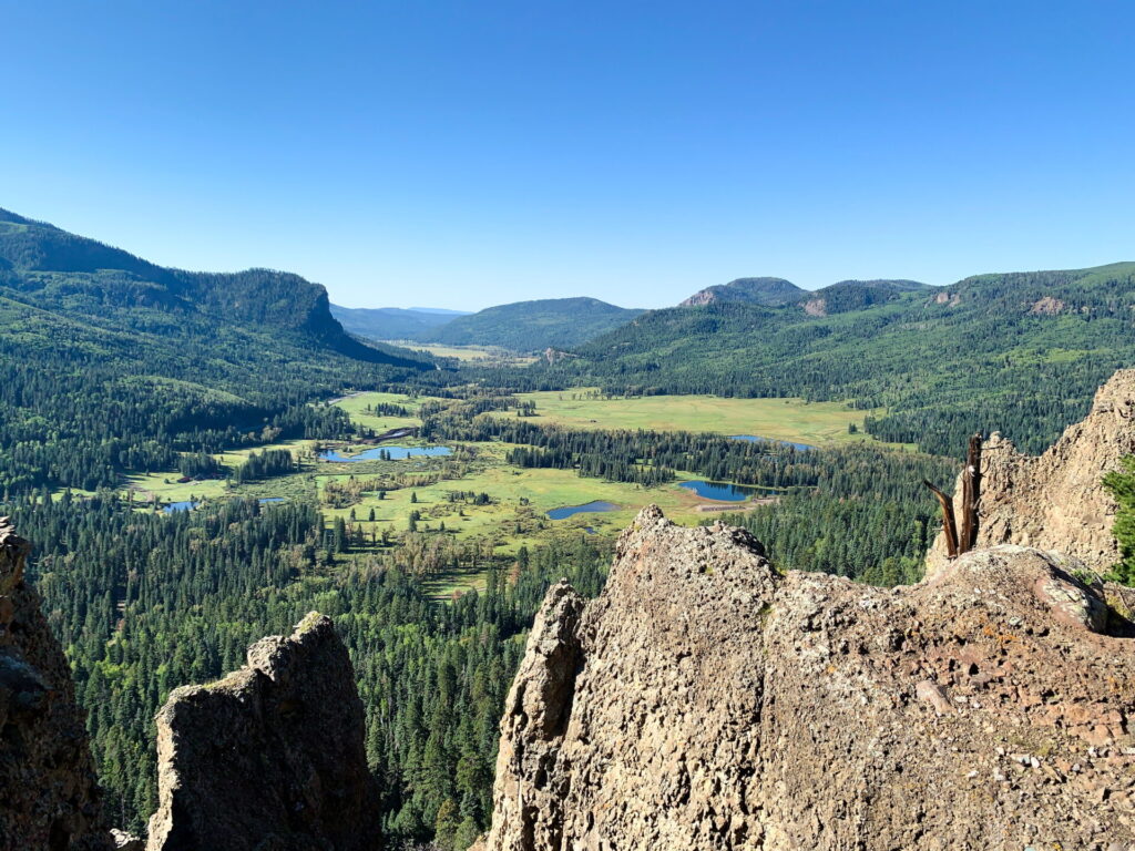
Skyline Drive
Distance: 2.5 miles
Time: 15 minutes
Where: Cañon City
This is the shortest scenic drive on the list, but it’s one of the most thrilling. For two and a half miles, you drive a long a ridge, with sharp drop offs on either side. This is a one lane road and does have a few places to pull over to let other cars pass, but it can still be a bit scary. If you’re afraid of heights, this one may not be for you.
Skyline Drive was out of the way for me, but I detoured through Cañon City on my way to Alamosa and Great Sand Dunes National Park just to do this scenic drive. It was exciting, but if I’m honest, there are better scenic drives in Colorado. Still, I’m glad I detoured for it.
Wolf Creek Pass
Distance: 42 miles
Time: 1 hour
Where: Highway 160 between Alamosa and Pagosa Springs (en route to Durango)
This is not necessarily a scenic drive, although it is incredibly beautiful, but a dangerous stretch of road on Highway 160 between Alamosa and Pagosa Springs. I first learned about this when I called to reserve my sand board at a shop in Alamosa. While making my reservation, we discussed my trip and they advised me to look up Wolf Creek Pass so that I would be prepared. I did some research and got very nervous. It was a lot less scary than I thought, but you still need to take caution. This is the only road I’ve ever driven that has giant signs with maps of the road with a “You Are Here” marker.
Wolf Creek Pass is full of hair pin turns and a very steep grade. Signs will be warning to use your low gear and I can definitely say that it’s helpful. I drove this earlier in the day, hitting the end of Wolf Creek pass just after 10:00 on a Sunday. There were very few cars on the road then and it made it feel that much easier.
Watch for the pull off for a scenic overlook. The views are spectacular and that’s why I’m including it on my list of the best scenic drives in Colorado.
San Juan Skyway Scenic Byway
Distance: 236 miles
Time: 7 hours for entire loop
Where: Southwestern Colorado
Note that you don’t have to drive the whole route. Here’s the stats for the section that I drove from Durango to Cortez:
Distance: 45 miles
Time: 1 hour
The San Juan Skyway is a Scenic Byway that forms a loop connecting Cortez, Durango, and Ridgeway. You could drive the whole loop, but because of timing issues, I only drove one section of it. If you’re going from Durango to Cortez to visit Mesa Verde National Park, you’ll end up on this Skyway.
I expected something more spectacular than it was (at least for the Durango to Cortez section). It was nice, but I felt let down. Once I readjusted my expectations, my drive from Cortez back to Durango was much more pleasant. This experience also helped me appropriately set expectations for other scenic drives in Colorado. For that reason alone, it was worth it. Plus, I didn’t really have any other options for getting from Cortez to Durango.
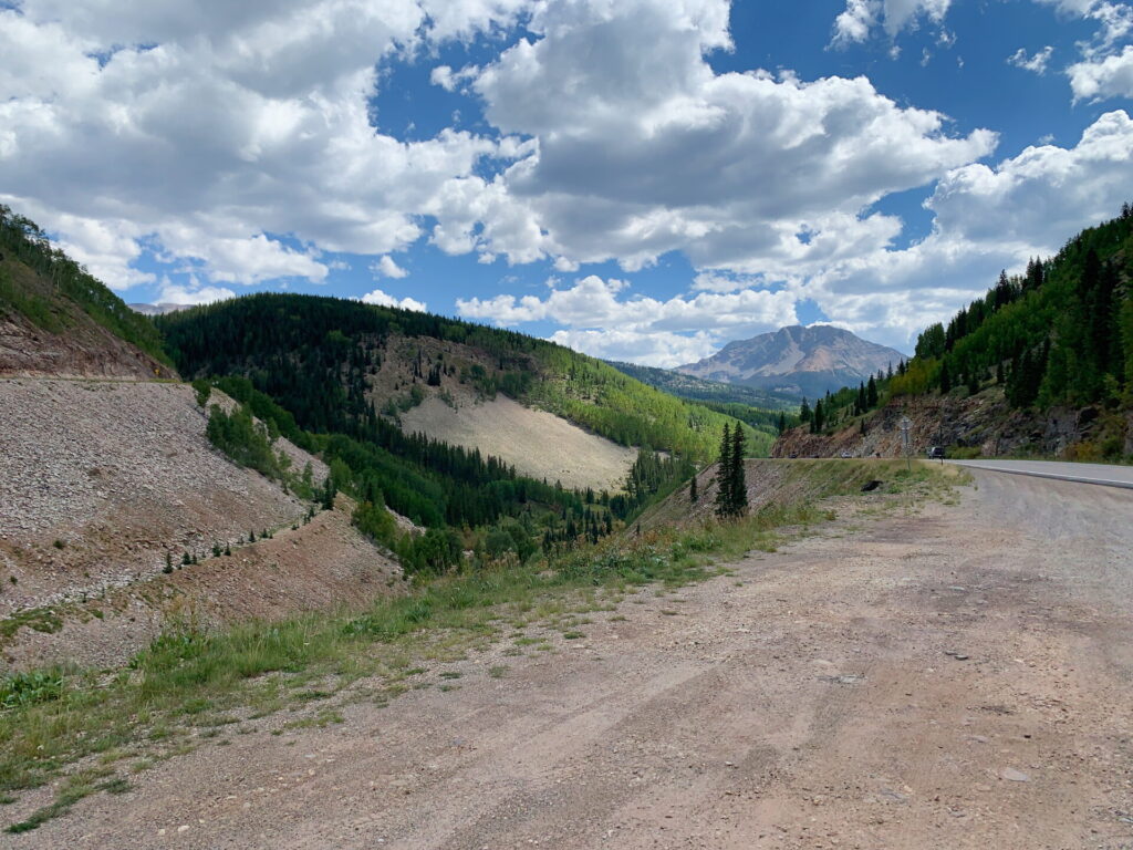
Million Dollar Highway
Distance: 80 miles
Time: 2 hours
Where: Durango to Ridgeway
The Million Dollar Highway is actually part of the San Juan Skyway and it connects Durango to Ridgeway. In my opinion, this is the best Colorado scenic drive. It’s everything I pictured Colorado to be and the views are just stunning.
You’ll pass by Silverton and will drive right through Ouray. Both towns can make a great place to stop and take a break for lunch.
If you’re heading from Mesa Verde National Park to Black Canyon of the Gunnison National Park, take this route. You won’t regret it.
Top of the Rockies Scenic Byway
Distance: 115 miles
Time: 4 hours
Where: Near Leadville
Top of the Rockies Scenic Byway is a strange section of road and it’s unlikely you’ll do the entire scenic drive, just because of the way it’s set up. There’s three different branches all spanning out from Leadville. So, if you’re coming to or from Leadville, though, you’ll end up on this scenic byway. I didn’t stay in Leadville, but I detoured through Leadville (from I-70) just to loop in this scenic drive.
The drive is nice, but I’m not positive if it’s necessarily worth detouring to go to it. That just may be bias on my side because I ended up injuring myself the next day so my time in Rocky Mountain National Park was cut short. Had I skipped this drive, I would have had just a bit more time for hiking before my injury.
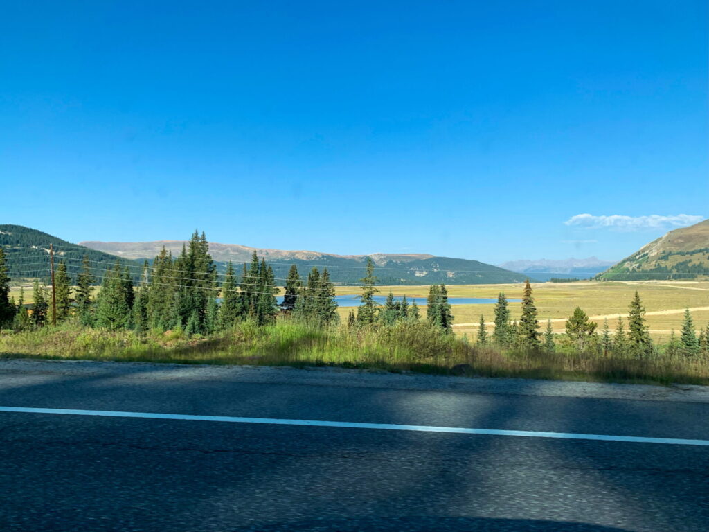
Colorado River Headwaters Scenic Byway
Distance: 80 miles
Time: 2 hours
Where: Grand Lake
This was a scenic byway that I didn’t intend to do, but as I drove toward Grand Lake and the western entrance to Rocky Mountain National Park, I found myself here. I was following my GPS to the next destination and I started noticing I was passing signs that indicated I was on a scenic byway. It wasn’t drop dead gorgeous scenery, but it was nice enough. I definitely wouldn’t detour just do to this byway, but it’s nice if you’re already going that direction.
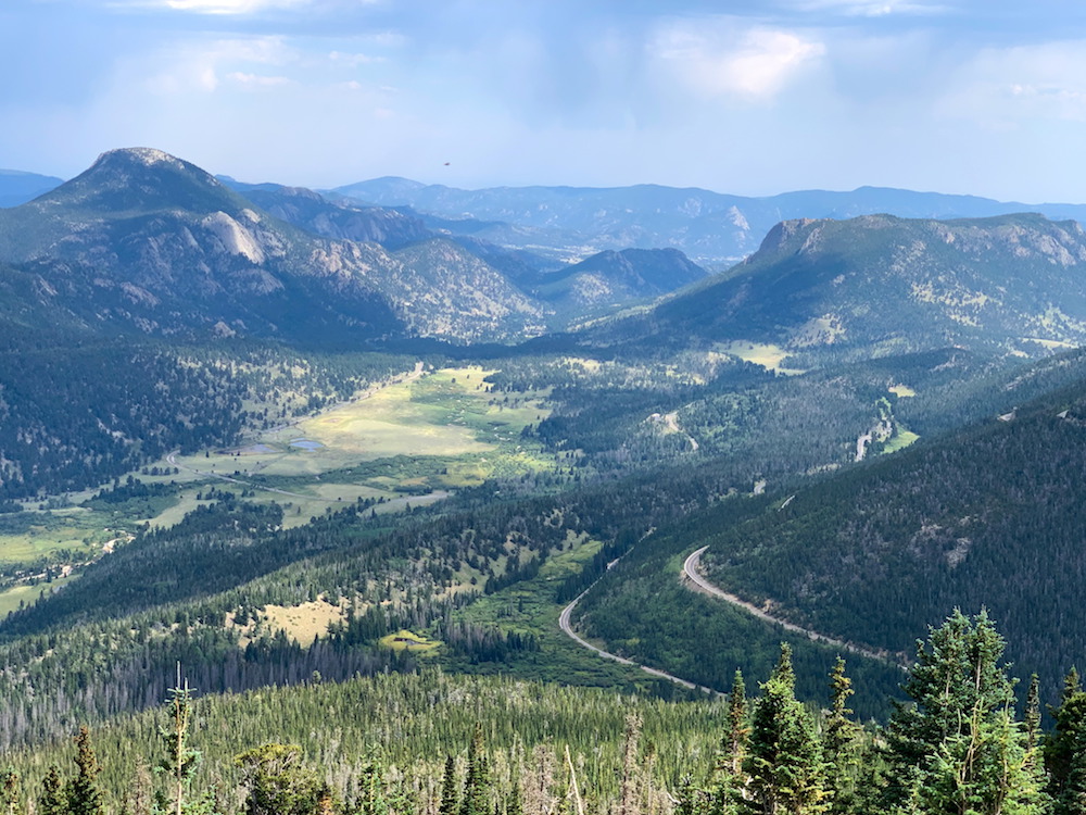
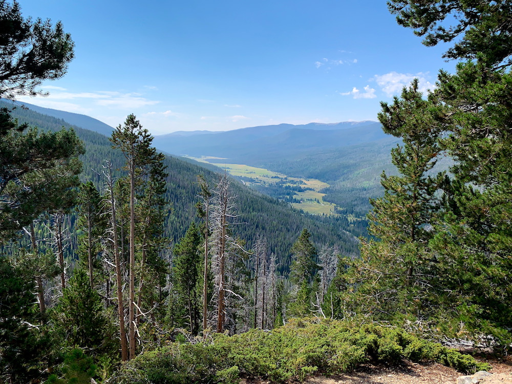
Trail Ridge Road Scenic Byway
Distance: 48 miles
Time: 2 hours (one way)
Where: Rocky Mountain National Park
Trail Ridge Road connects Grand Lake to Estes Park via Rocky Mountain National Park. It’s a top attraction in Rocky Mountain National Park and if you’re visiting, it should not be missed. In the west, you see the remains of 2020 forest fires before entering the mountains. You’ll climb up until you’re above the tree line in the tundra, before descending again in to pure mountain beauty. This is a scenic drive that has a little bit of everything and that helps to make it one of my favorite national park scenic drives.
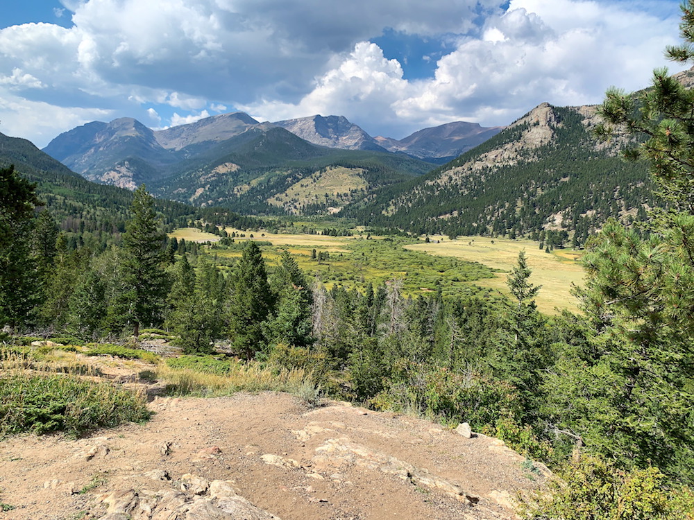
I entered Rocky Mountain National Park from Grand Lake on a clear day. This allowed me to only drive the road one way. From my research it seems most people will start and end their Trail Ridge Road drive in Estes Park. It’s wonderful and definitely in my top scenic drives in Colorado, but one way is enough.
One important note on this scenic route. If you plan to drive this route between 9:00am and 2:00pm, you must get a timed entry reservation.
Bonus: If you’re starting and ending your drive in Estes Park, consider using the one way Endovalley Road, which starts near the eastern side of the park and finishes at the Alpine Visitor Center. This just helps to give you a little bit different scenery (although I don’t think it’s bad if you drive through the same scenery on Trail Ridge Road twice). I didn’t do this because I entered the park at Grand Lake, so I only had to drive Trail Ridge Road one way.
Peak to Peak Scenic Byway
Distance: 55 miles
Time: 2 hours
Where: Estes Park to Black Hawk
I wish I had more I could say about this drive. I only drove two thirds of it, but it was completely covered in fog for most of the way. I’m assuming it’s nice as you’re driving through the Rocky Mountains, just outside of Rocky Mountain National Park, but I can’t actually speak to how nice it is. All I can say is that the photos that others have taken look beautiful.
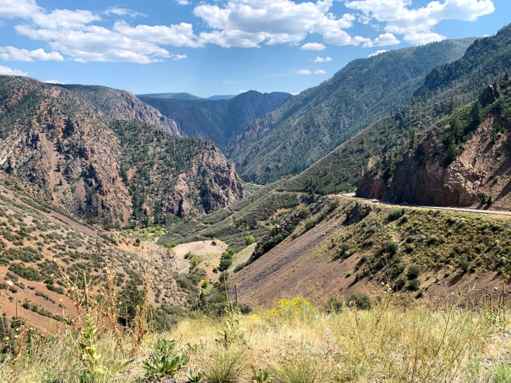
East Portal Road at Black Canyon of the Gunnison
Distance: 7 miles
Time: 30 minutes
Where: Black Canyon of the Gunnison National Park (South Rim)
This road was fun to drive. From the Black Canyon of the Gunnison South Rim Entrance Station, it’s a seven mile drive to the East Portal Recreation area. The road is steep, with grades of up to 16% and winds it’s way down to the Gunnison River at the bottom of the canyon and is a great way to spend some time at Black Canyon of the Gunnison.
Highway 60 From Cañon City to Salida
Distance: 59 miles
Time: 1.5 hours
Where: Cañon City to Salida
This is not designated a scenic drive, so why am I even bothering to include it? Because it surprised me and I really enjoyed this drive, even more that some of the designated Colorado scenic drives. If you’re heading from Cañon City to Alamosa, you’ll end up on Highway 60 following the Arkansas River. The views are beautiful as you look up at the gorge surrounding you. This drive made me want to come back and spend more time in this part of Colorado, so it deserves an honorable mention.
Which Are the Best Colorado Scenic Drives?
I enjoyed all of the scenic drives in Colorado. Almost every one was worth it, especially if it’s convenient. But if you’re short on time, my top three favorite Colorado scenic drives are:
- Million Dollar Highway. This is likely what you envision when you think of Colorado.
- Trail Ridge Road. If you’re going to spend time in Rocky Mountain National Park, you’ll be on this road. The views are great and diverse as you drive the entire route.
- East Portal Road. For a road I didn’t plan to drive, this was incredible.
Tips for Driving in Colorado
None of these scenic drives require a 4×4. A standard car will suffice. That said, I had rented a Nissan Rogue and I was grateful to have a slightly bigger and more powerful car (rather than the basic economy car I normally rent) on some of these mountain roads. I’m not sure if it actually made a difference, but it made me feel safer, which has to count for something.
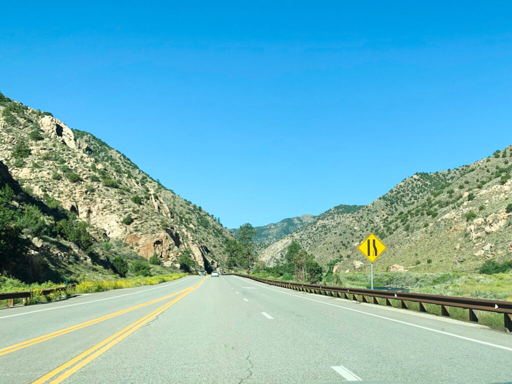
Make sure you know how to use the low gear in your car. On many of these Colorado scenic drives, it’s not uncommon to pass signs just before steep descents stating that you need to switch to your low gear. The low gear makes it so you don’t have to ride your brakes all the way down the mountain. If you skip using low gear and just rely on your brakes, you’ll burn through your brakes and then you’ll really be in trouble.
Take your time. While there were a few cars that sped past me, in general I found that traffic was either going the speed limit or barely over. Especially on the mountain roads, slow down if you need to. Drive safely.
Know the rules about when to pull over. In general if you’re driving on a mountain road and you notice you have a whole line of cars behind you, you need to pull over when it’s safe to do so and let them pass. The rule is five cars, but I’m sure if you have less than five cars behind you, they’ll appreciate it.
Drive in the right lane. The left lane is only for passing.
Don’t rely on the mileage remaining for gas. Look at the fuel tank and determine if you need gas based on how full your tank is. At higher elevations, your car needs more gas and that throws off the mileage estimation. I picked up my rental car and it had a full tank with 485 miles to go. Through the rest of my fill ups (where I put in enough gas to get to a completely full tank), the car told me 405 miles to go, 515 miles, 415 miles, 475 miles, etc. despite having a completely full tank of gas. Some of these drives are pretty remote, so make sure you have plenty of gas.
Continue Your Adventure
Colorado National Parks: Colorado is home to four national parks. Try your hand at sandboarding at Great Sand Dunes, tour the cliff dwellings at Mesa Verde, explore the canyon at Black Canyon of the Gunnison, and don’t miss all of the epic views and hikes at Rocky Mountain.
More in Colorado: There’s more to Colorado than national parks. Take your pick of the numerous scenic drives. In Colorado Springs, visit Garden of the Gods or drive to Pike’s Peak. Learn more with my Colorado Travel Guide, which also features my ten day Colorado itinerary as well as some shorter Colorado itineraries.
US National Parks: Start planning your national park vacation with my US National Park Travel Guide. You’ll find information about each park, photos, itineraries, budget tips, advice for non-hikers, the best scenic drives, and more. Plus, don’t forget to book your timed entry reservations in advance!
Maybe this holiday since I’ll be on my own I’ll take you up on these routes.